 |
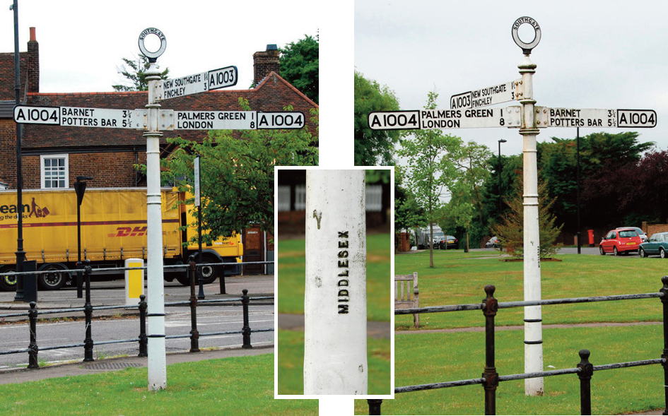
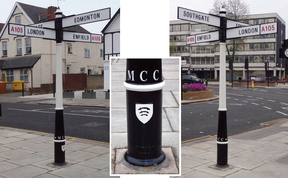
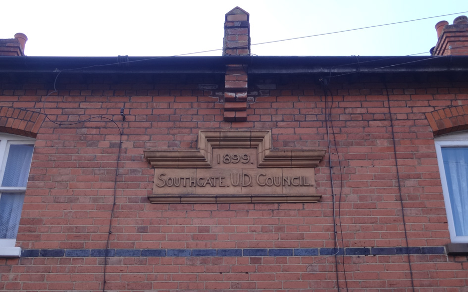
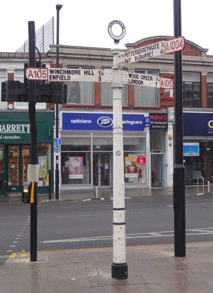
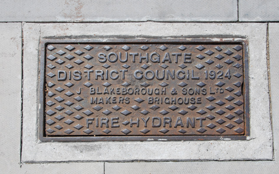
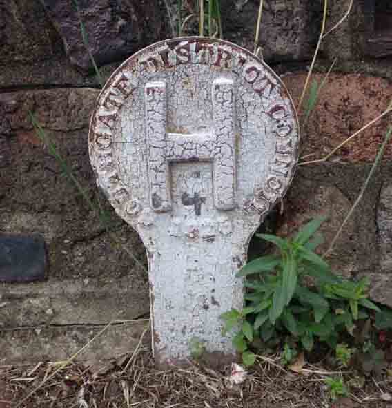
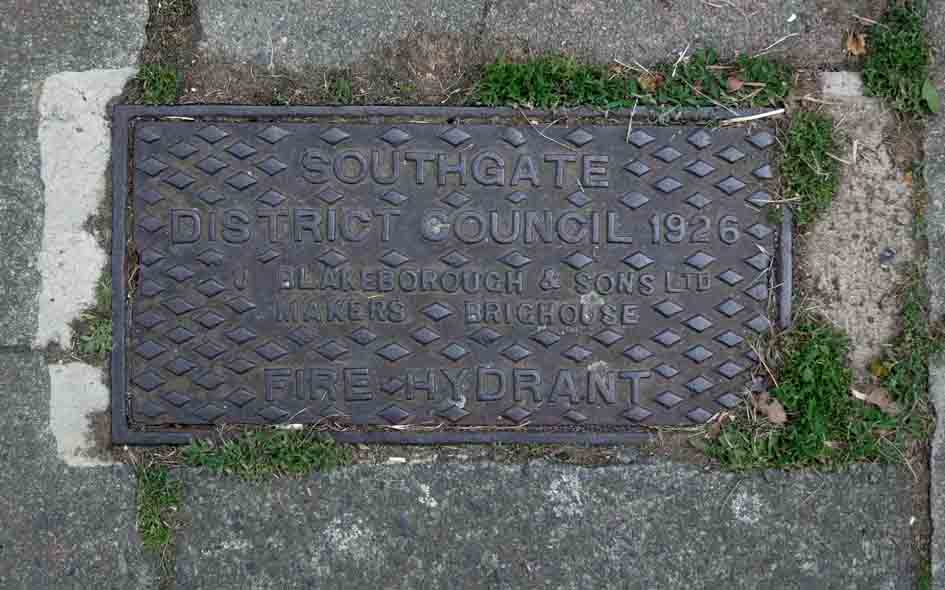
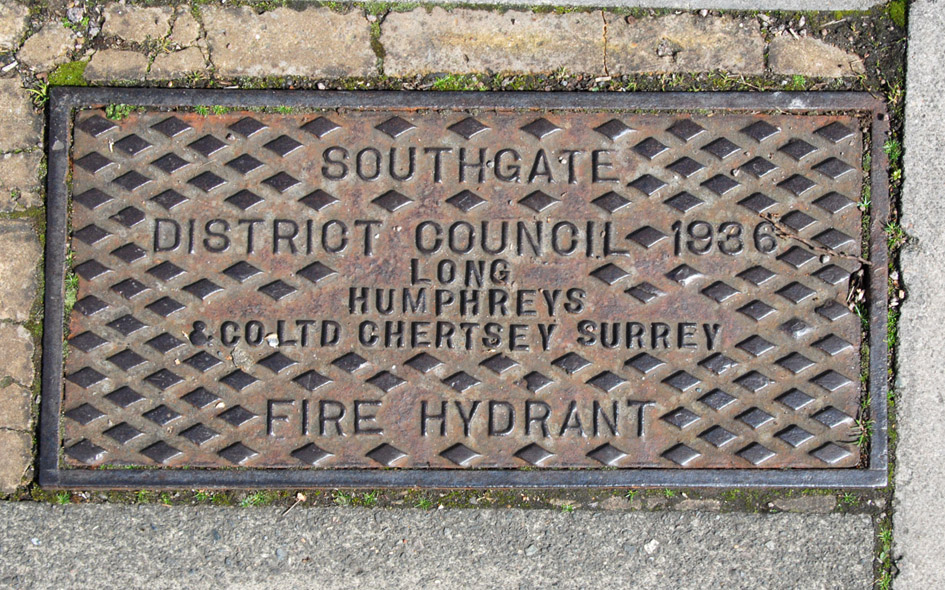
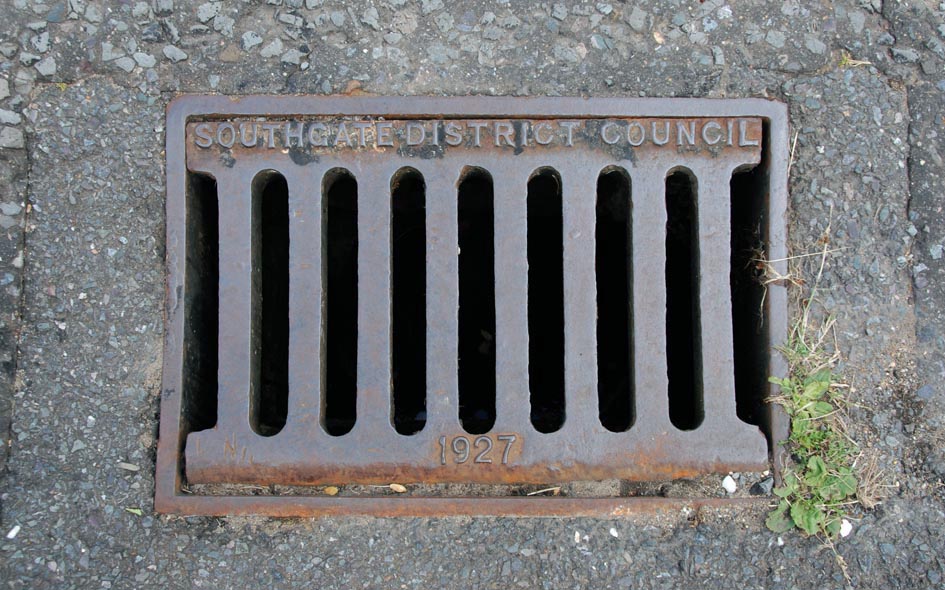
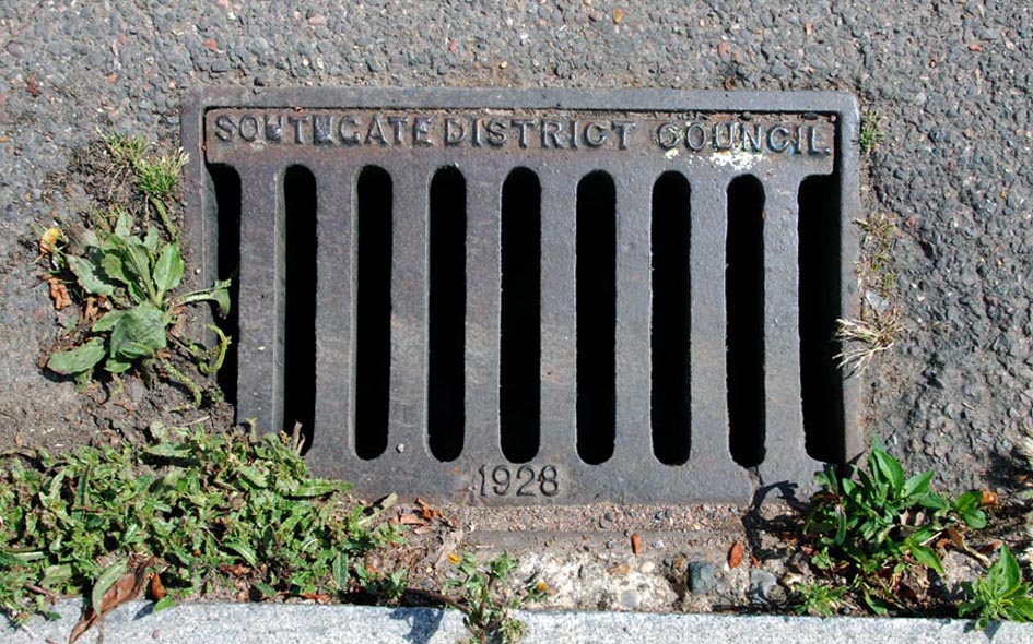
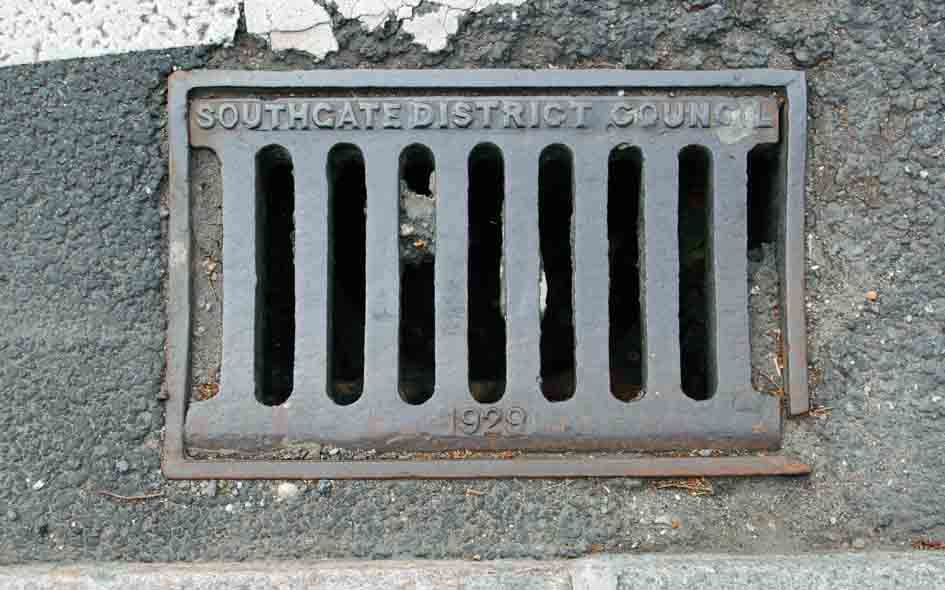
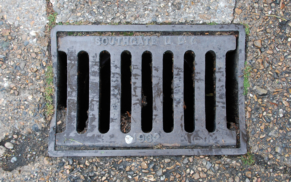
Southgate Urban District Council (1894–1933) |
 |
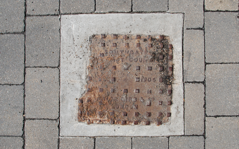
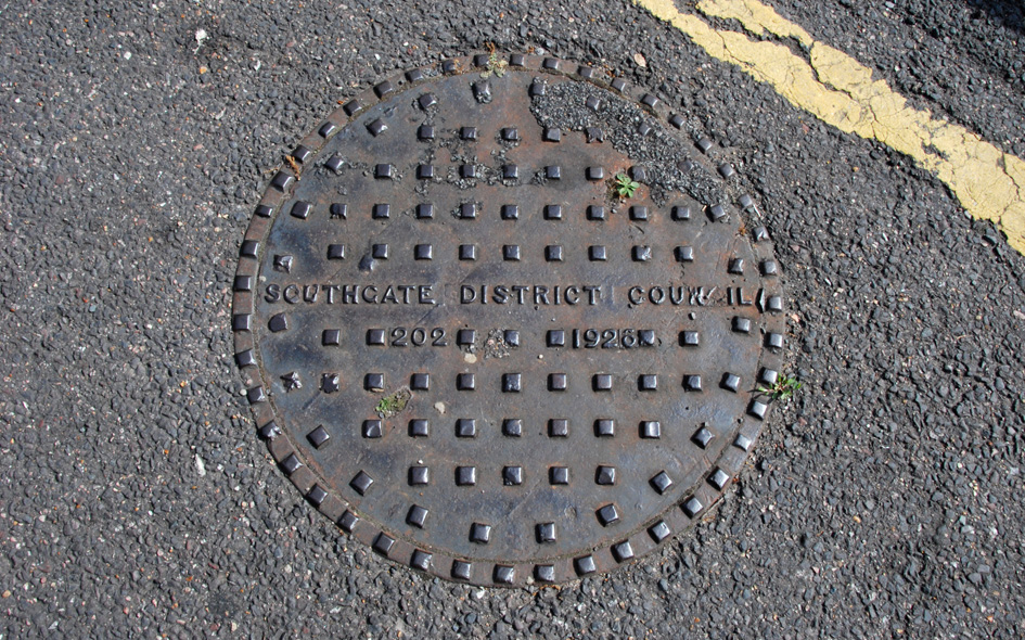
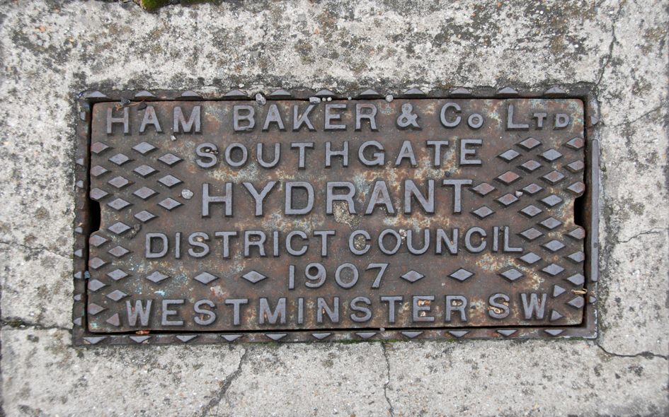
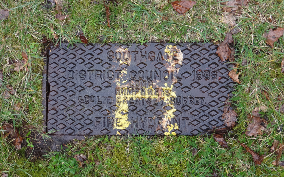
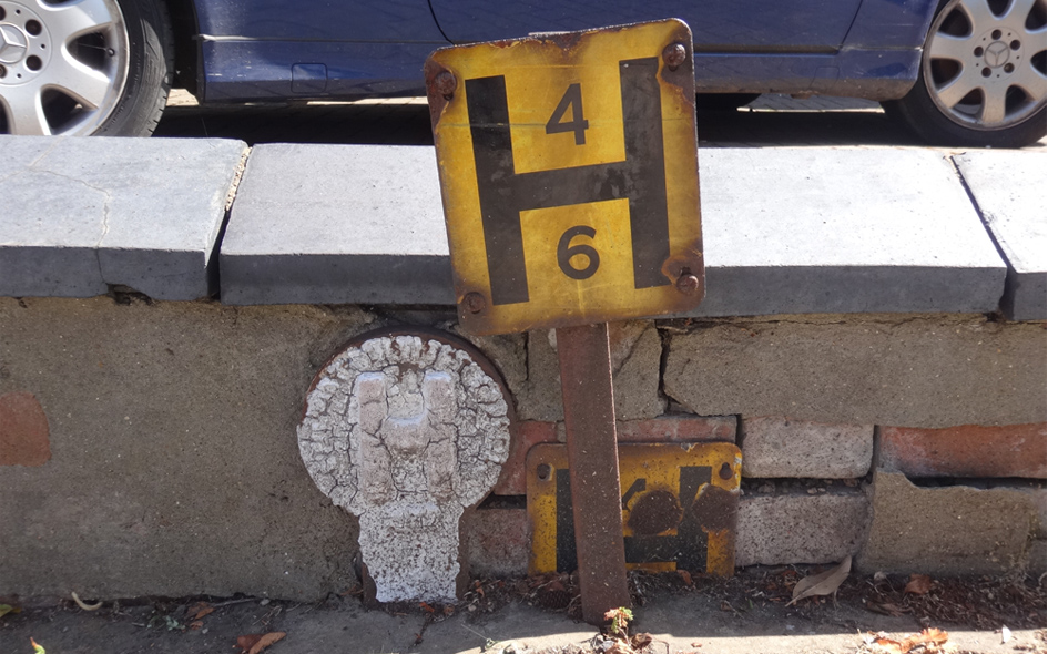
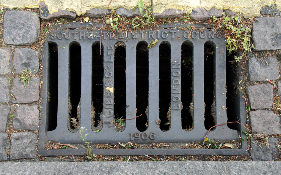
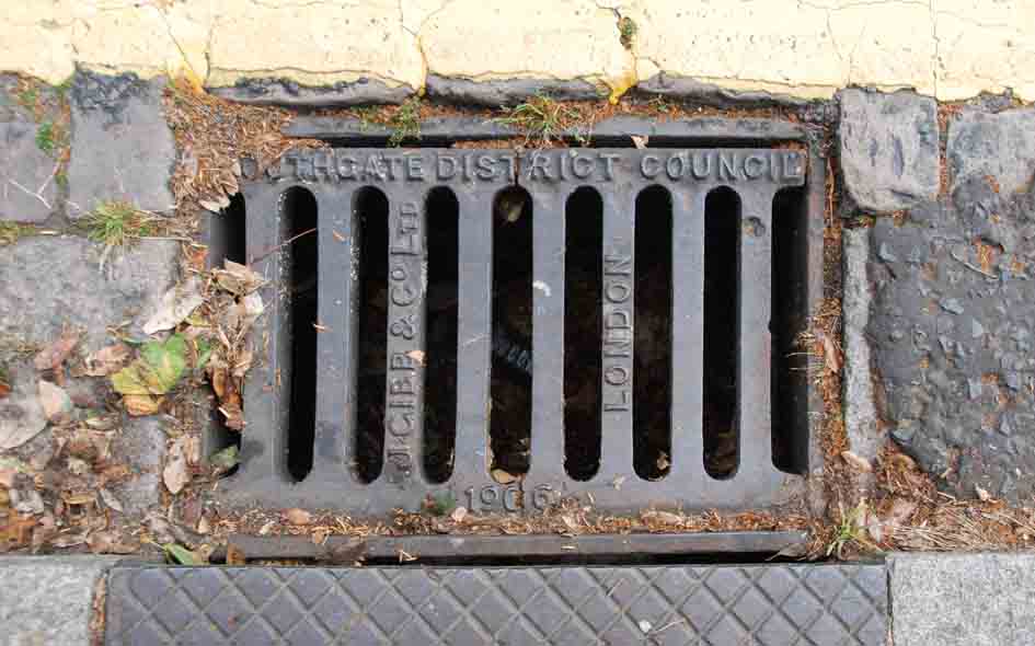
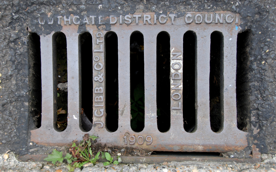
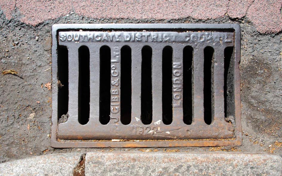
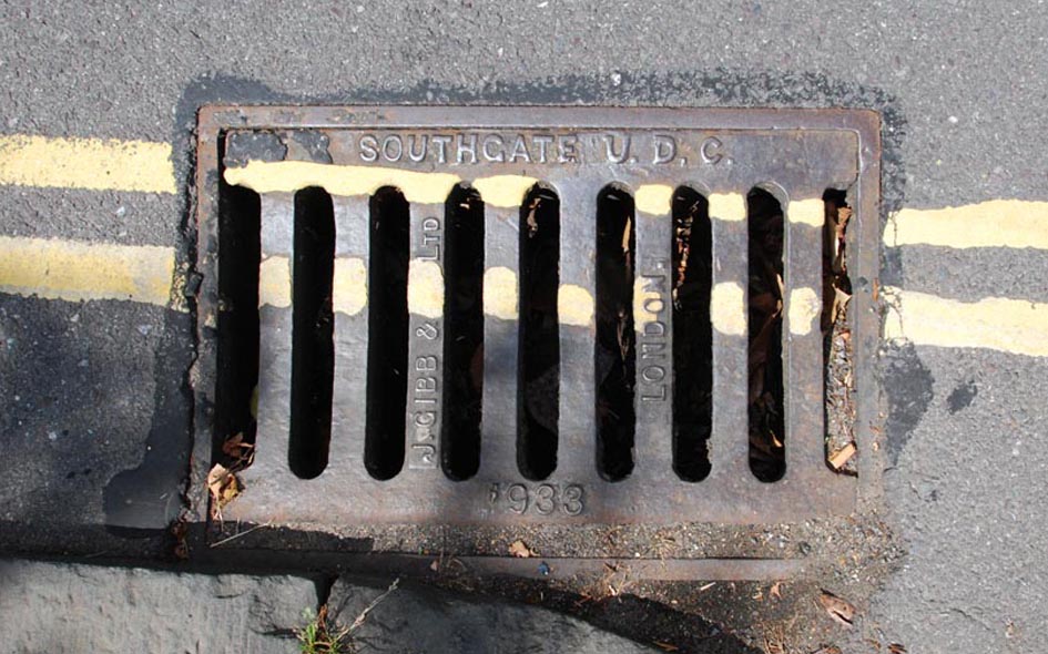
ENF024: The Green, at junction with Cannon Hill, south-west corner; N14; [please refer to the historical notes by clicking here]
29th May 2017 |
| |
 |
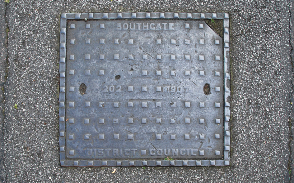
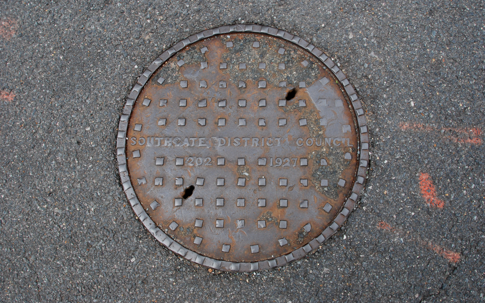
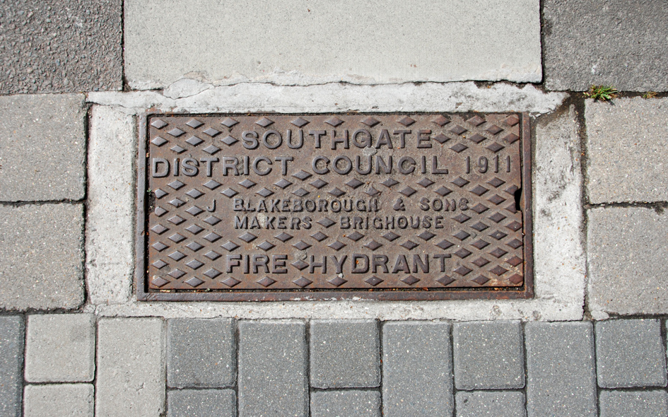
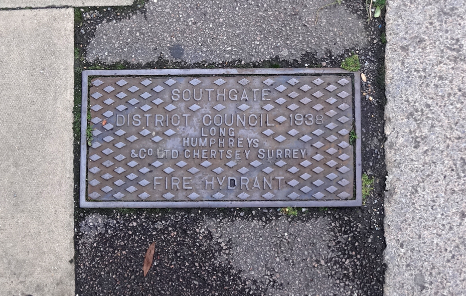
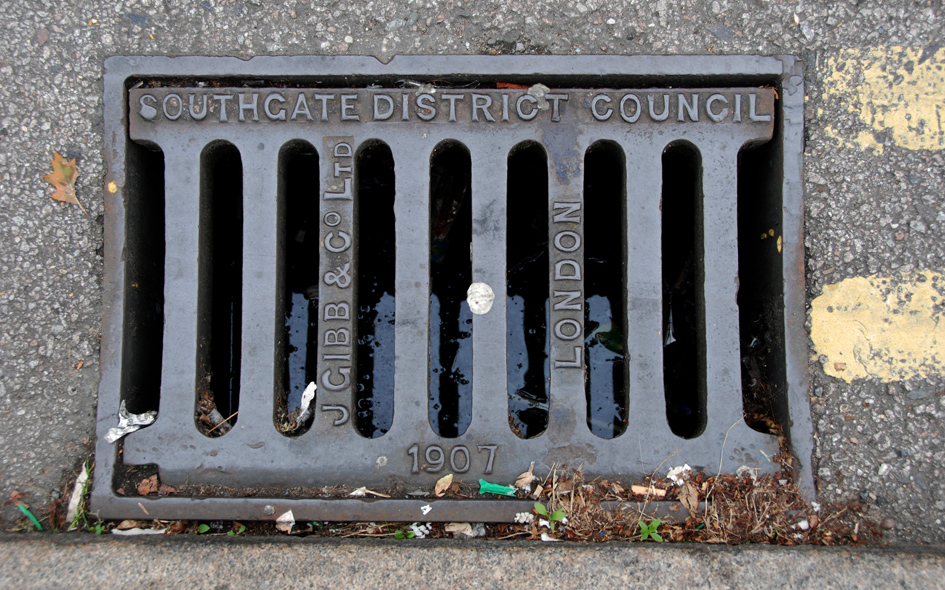
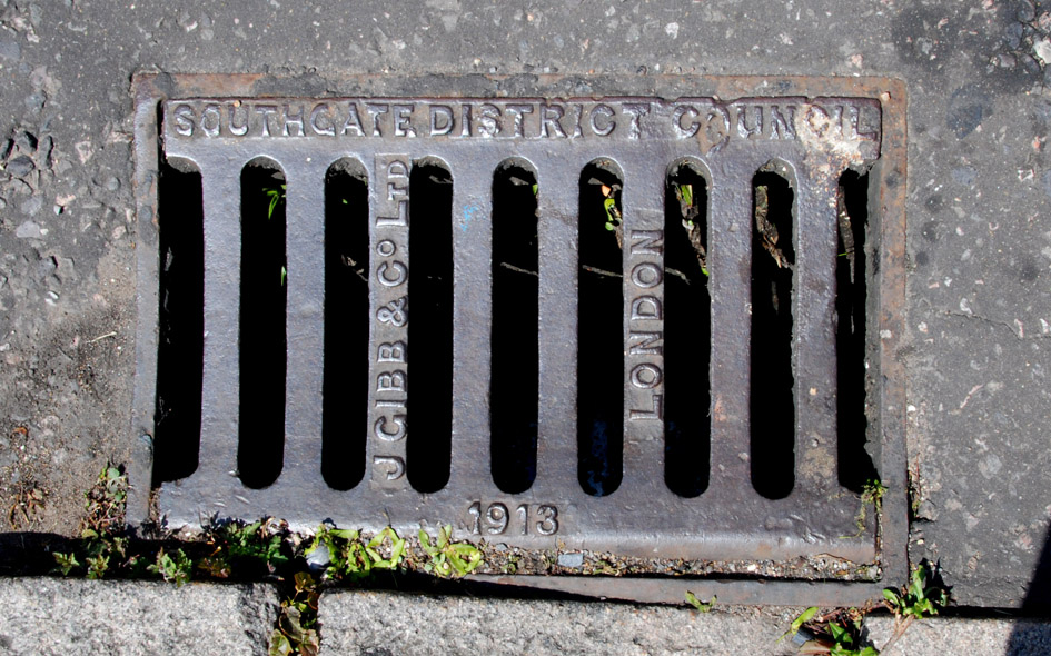
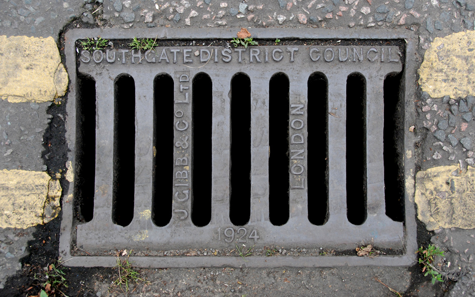
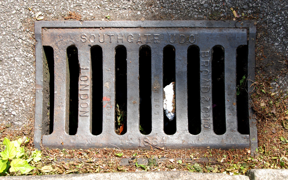
ENF020: Green Lanes, at junction with Station Road; N21; [please refer to the historical notes by clicking here]
7th April 2019 [courtesy of John Liffen] |
| |
 |
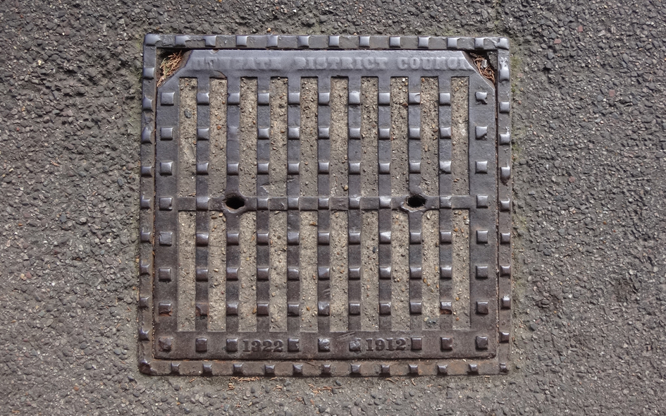
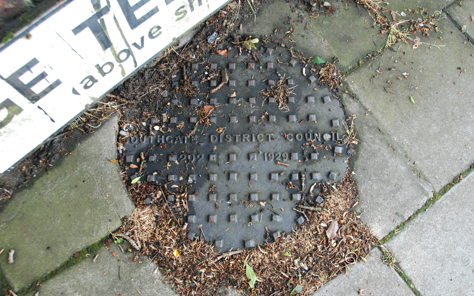
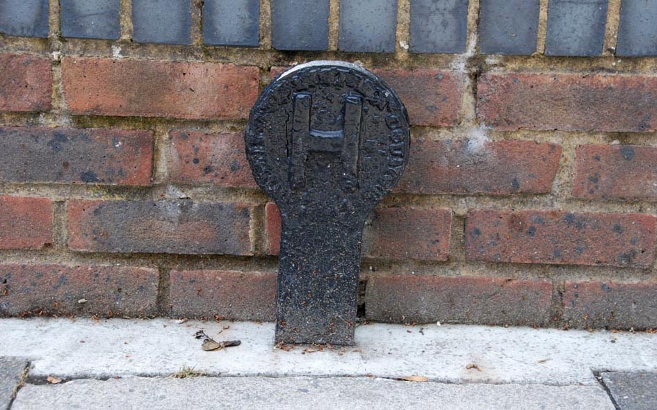
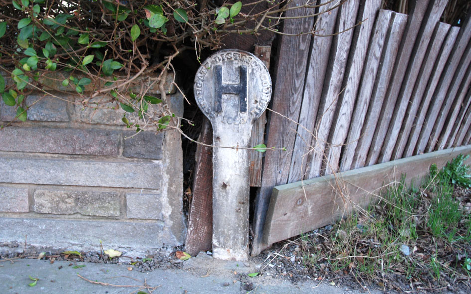
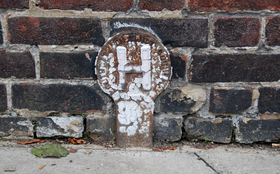
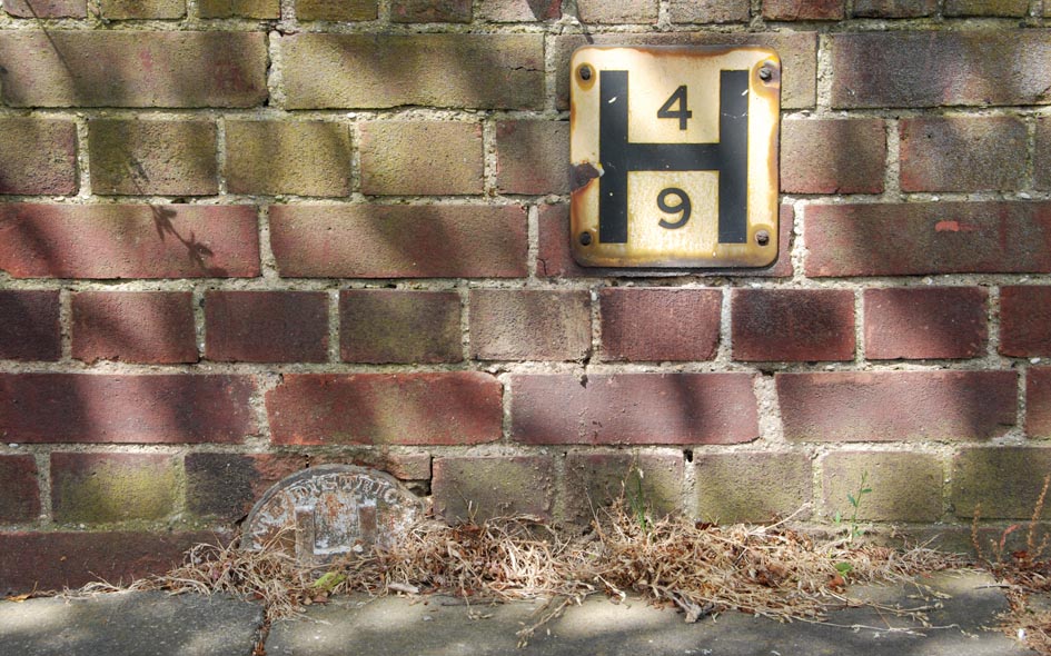
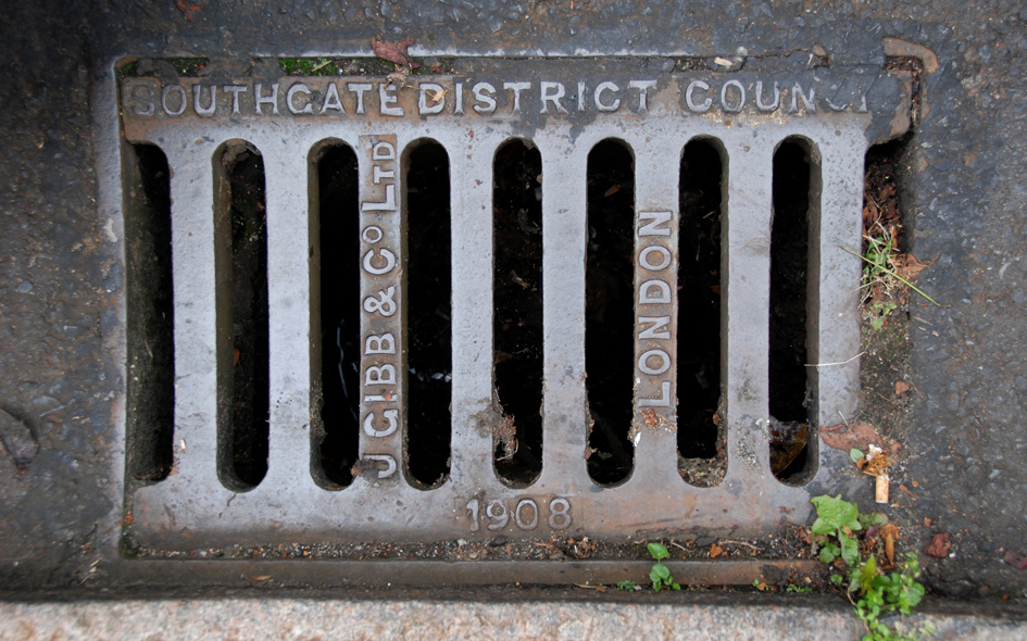
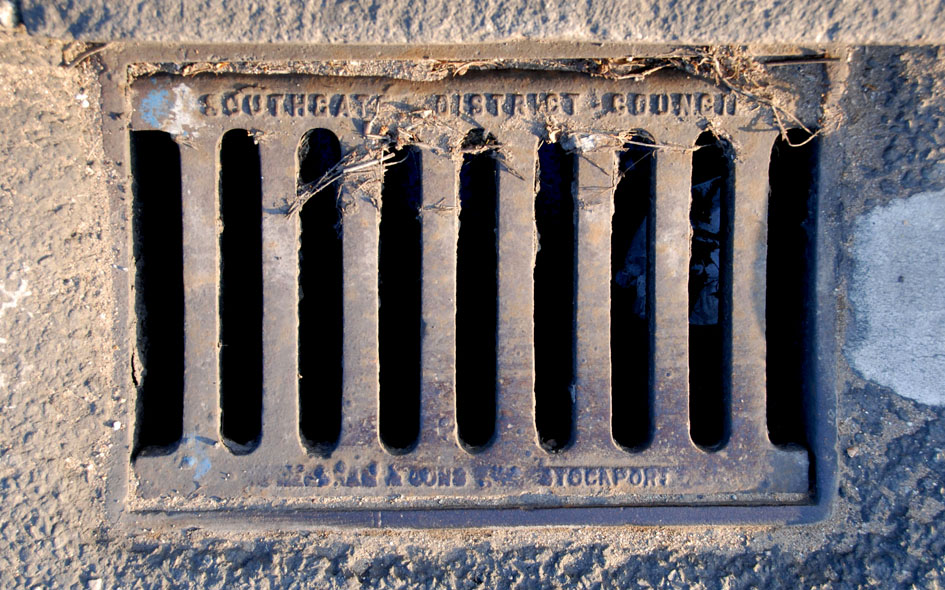
ENF137: Highfield Road, on wall above and between nos.44 and 46; N21;
29th April 2021 [courtesy of John Liffen] |
| |
 |
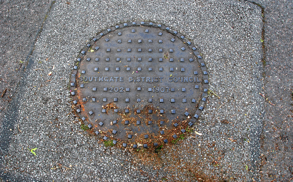
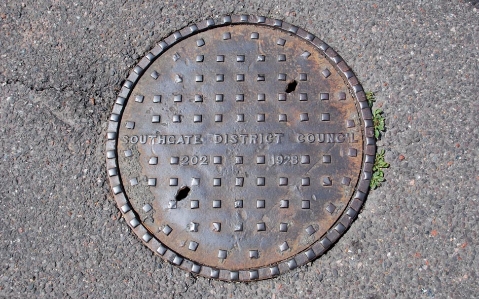
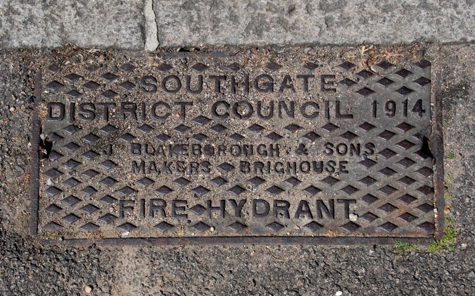
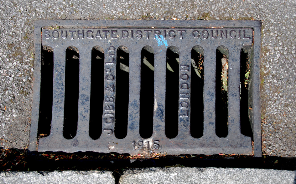
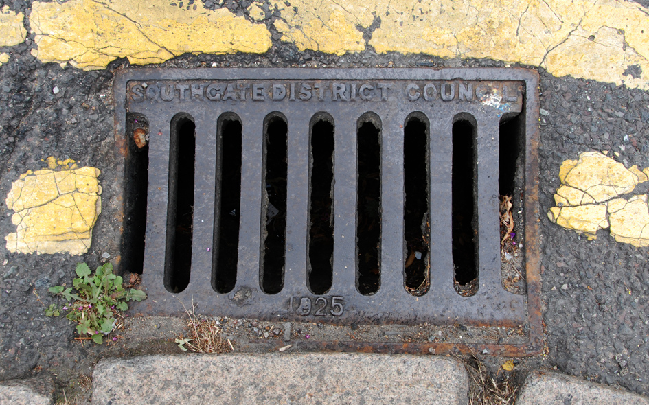
ENF023: Green Lanes, at junction with Aldermans Hill; N13; [please refer to the historical notes by clicking here]
7th April 2020 [courtesy of John Liffen] |
| |
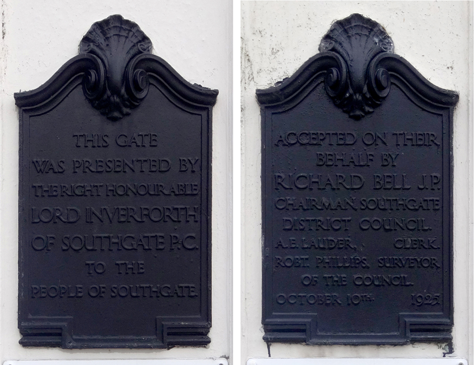 |
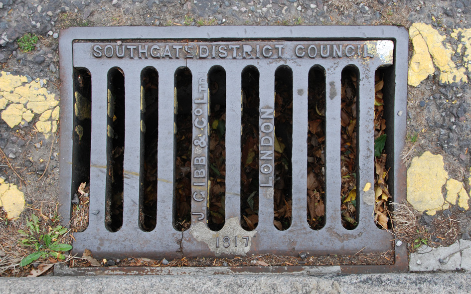
ENF133: Bourne Hill, pillars of Inverforth Gate entrance to Grovelands Park; N14
16th March 2021 [courtesy of John Liffen] |
| |
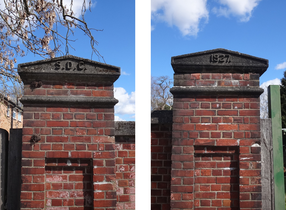 |
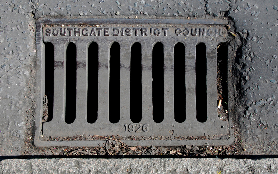
ENF136: Hazelwood Lane, on north bridge pier cappings over New River; N13
6th April 2021 [courtesy of John Liffen] |
| |
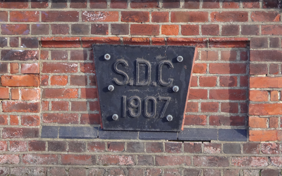 |
ENF144: Powys Lane, bridge over Pymmes Brook, west side; N14;
26th February 2022 [courtesy of John Liffen] |
| |
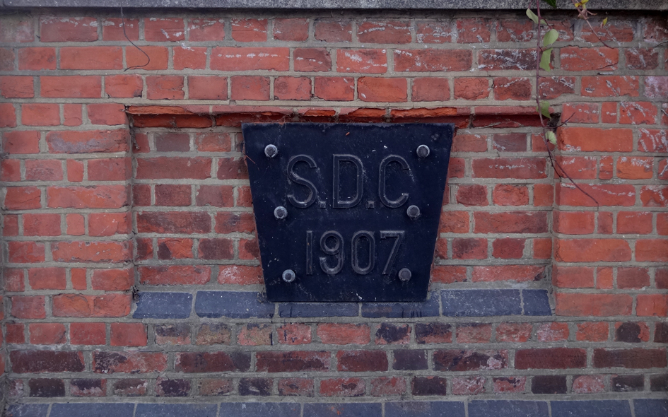 |
ENF145: Powys Lane, bridge over Pymmes Brook, east side; N14;
26th February 2022 [courtesy of John Liffen] |
| |
 |
ENF033: Green Lanes, outside no.884; N21;
18th June 2020 |
| |
 |
ENF035: Tewkesbury Terrace, middle of road outside no.29; N11;
10th May 2015 |
| |
 |
ENF097: Bush Hill, in road on west side, opposite no.35; N21;
2nd September 2020 [courtesy of John Liffen] |
| |
 |
ENF034: Tewkesbury Terrace, middle of road outside no.37; N11;
10th May 2015 |
| |
 |
ENF036: Tewkesbury Terrace, middle of road outside no.73; N11;
10th May 2015 |
| |
 |
ENF037: Arnos Grove, in road at junction with Minchenden Crescent; N14;
20th June 2020 |
| |
 |
ENF038: Forestdale, in road at junction with Minchended Crescent; N14;
20th June 2020 |
| |
 |
ENF039: Ridge Terrace [Green Lanes], by alleyway next to no.928; N21;
18th June 2020 |
| |
 |
ENF040: Green Lanes, at junction with Berry Close; N21;
18th June 2020 |
| |
 |
ENF041: Green Lanes, at junction with Berry Close; N21;
18th June 2020 |
| |
 |
ENF042: Highfield Road, south side, at junction with Green Lanes; N21;
18th June 2016 |
| |
 |
ENF087: Green Dragon Lane, outside no.24; N21;
22nd June 2020 [courtesy of John Liffen] |
| |
 |
ENF043: Green Lanes, outside no.884; N21;
18th June 2020 |
| |
 |
ENF047: Green Lanes, west side, near junction with south slip road; N21;
[junction subsequently re-built and artefact gone];
18th June 2016 |
| |
 |
ENF050: Green Lanes, outside no.935; N21;
18th June 2020 |
| |
 |
ENF044: Green Lanes, outside no.935; N21;
18th June 2020 |
| |
 |
ENF045: Berkshire Gardens, outside no.88; N13;
16th May 2015 |
| |
 |
ENF046: Green Lanes, outside no.836; N21;
18th June 2020 |
| |
 |
ENF089: Firs Lane, outside no.163; N21;
11th July 2020 [courtesy of John Liffen] |
| |
 |
ENF088: Firs Lane, outside no.163; N21;
11th July 2020 [courtesy of John Liffen] |
| |
 |
BAR067: Chase Side, outside no.219; N14;
6th April 2015 |
| |
 |
ENF130: Broad Walk, outside no.3A; N9;
10th March 2021 [courtesy of John Liffen] |
| |
 |
ENF143: Green Lanes, Palmers Green, west side, outside no.175;
31st October 2021 courtesy of John Liffen] |
| |
 |
ENF048: Betstyle Road, north side, on corner of access road to Cranbrook Lane; N11;
22nd March 2015 |
| |
 |
ENF049: Station Road, outside no.2, at junction with Green Lanes; N21;
18th June 2016 |
| |
 |
ENF086: Green Dragon Lane, outside no.24; N21;
22nd June 2020 [courtesy of John Liffen] |
| |
 |
ENF051: Morton Way, outside no. 63; N14;
20th June 2020 |
| |
 |
ENF052: Fernleigh Road, south side, at junction with Green Lanes; N21;
18th June 2016 |
| |
 |
ENF053: Fernleigh Road, vicinity of junction with Green Lanes; N21;
18th June 2020 |
| |
 |
HGY026: Oak Lane, outside side of no.24 Maidstone Lane; N11;
10th May 2015 |
| |
 |
ENF054: Cannon Road, north side, near junction with Cannon Hill; N14;
20th June 2020 |
| |
 |
ENF055: Compton Road, south side of north slip road at junction with Green Lanes; N21;
[junction subsequently re-built and artefact gone];
18th June 2016 |
| |
 |
ENF056: Queens Avenue, outside no.33; N21;
18th June 2016 |
| |
 |
ENF057: Queens Avenue, outside no.43; N21;
18th June 2016 |
| |
 |
ENF058: Berkshire Gardens, outside no.78; N13;
16th May 2015 |
| |
 |
ENF059: Tewkesbury Terrace, outside no.33; N11;
10th May 2015 |
| |
 |
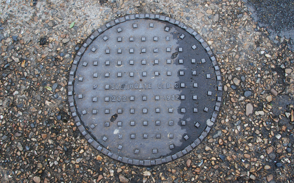
ENF025: Southgate High Street, just north of junction with The Close; N14;
6th July 2020 |
| |
 |
ENF060: Cannon Hill, east side, outside St. Monica’s Parish Centre; N14;
20th June 2020 |
| |
 |
ENF061: Green Lanes, just south of junction with Carpenter Gardens; N21;
18th June 2020 |
| |
 |
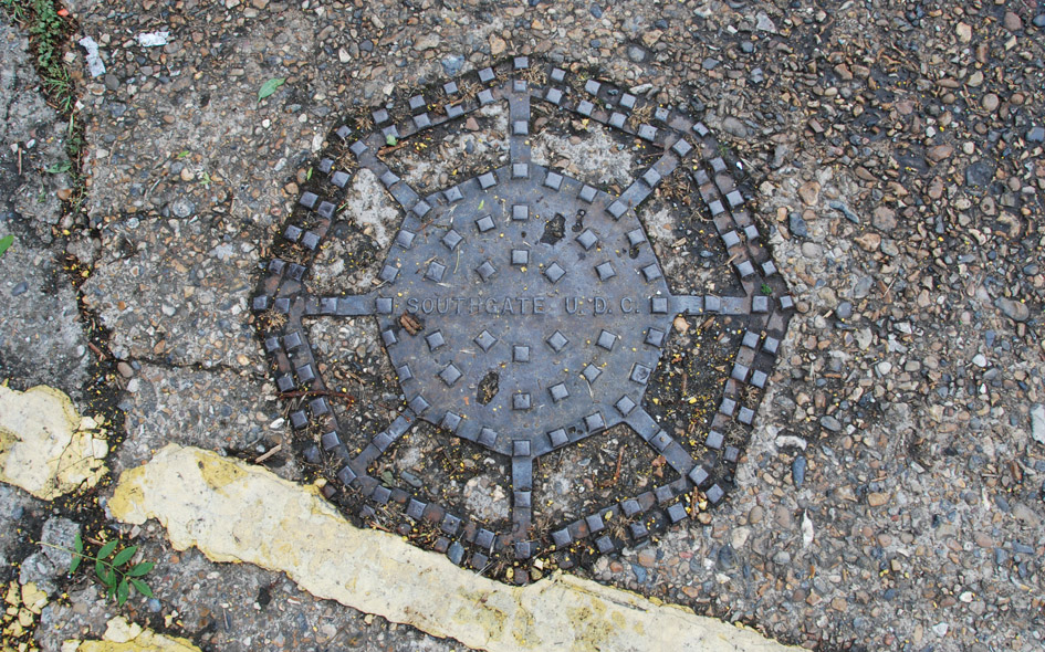
ENF026: Southgate High Street, at junction with Meadway; N14;
6th July 2020 |
| |
 |
BAR068: Chase Side, west side, outside playing fields, opposite no.266; N14;
6th April 2015 |
| |
 |
ENF062: Arnos Grove, outside no.66; N14;
20th June 2020 |
| |
 |
ENF063: Forestdale, north side, near junction with Minchenden Crescent; N14;
20th June 2020 |
| |
 |
ENF064: Cannon Hill, east side, near junction with Cannon Road; N14;
20th June 2020 |
| |
 |
ENF065: Green Lanes, at junction with Berry Close; N14;
18th June 2020 |
| |
 |
ENF066: Forestdale, south side, at junction with Cannon Hill; N14;
20th June 2020 |
| |
 |
ENF067: Tewkesbury Terrace; N11;
10th May 2015 |
| |
 |
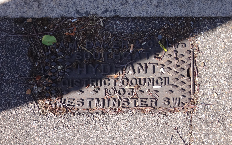
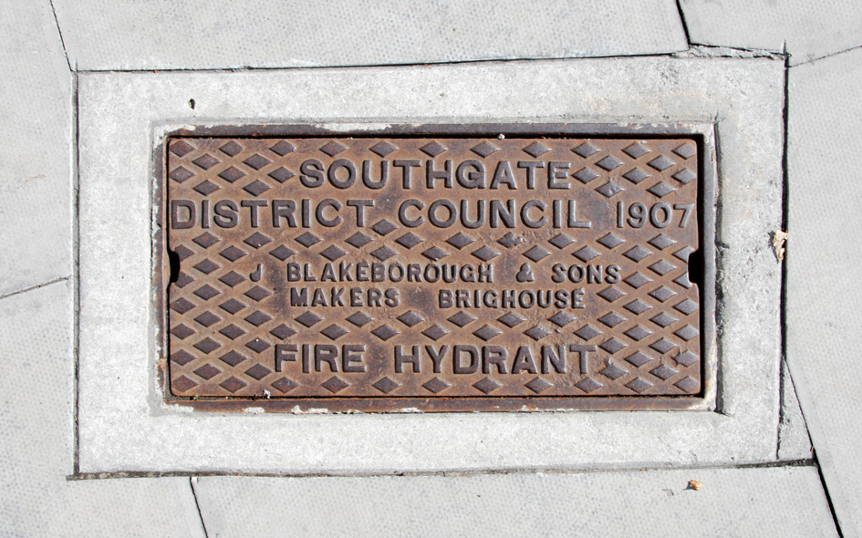
ENF068: Waterfall Road, outside no.96; N14;
22nd March 2015 |
| |
| |
| * * * |
| |