 |
Ordnance Survey (1791date) [further information can be found by clicking here] |
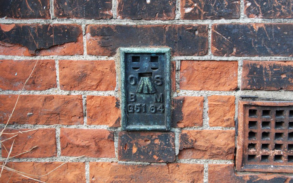 |
ENF028: High Street (Hertford Road), on south facing side wall of ‘The Boundary House’; EN3;
16th August 2015 |
| |
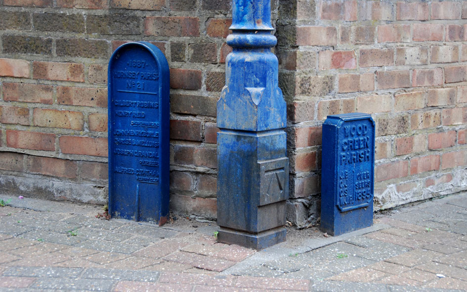 |
HGY025: Arnold Bennett Way [civil parish boundary markers either side]; N8;
13th June 2015 |
| |
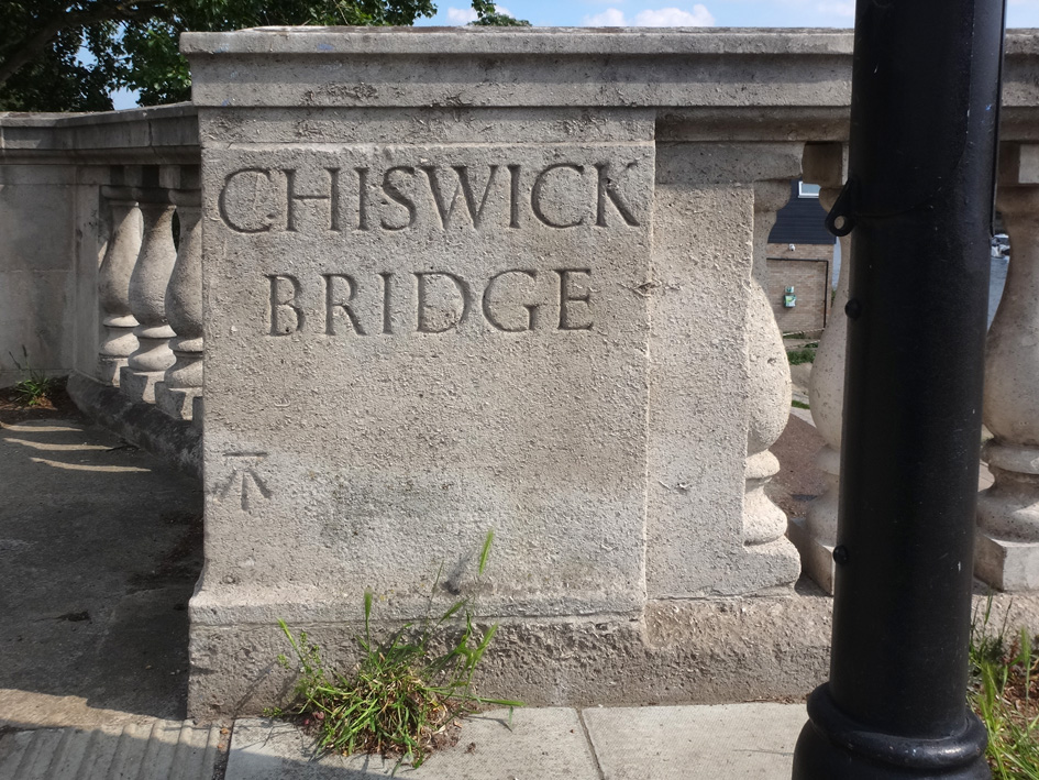 |
HLW002: Chiswick Bridge, north-east end; W4;
29th May 2021 [courtesy of John Liffen] |
| |
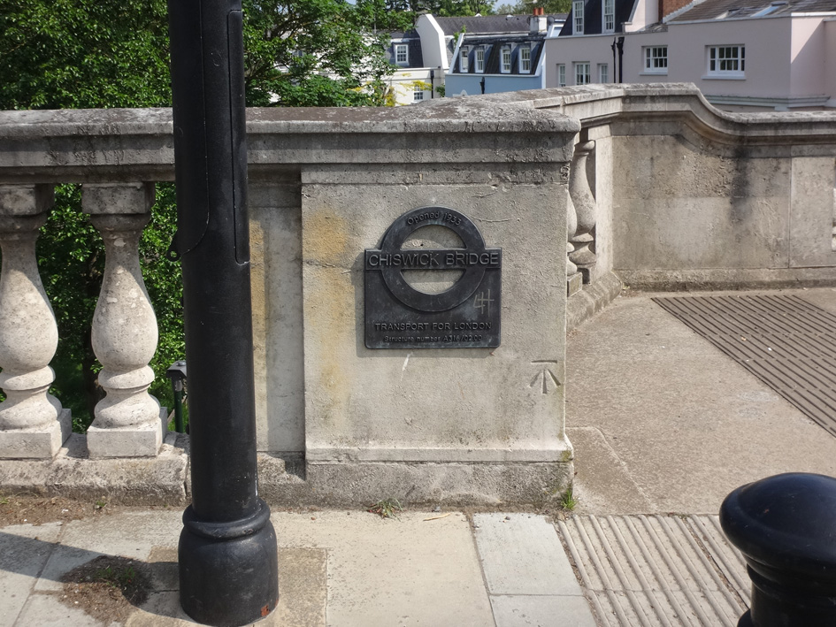 |
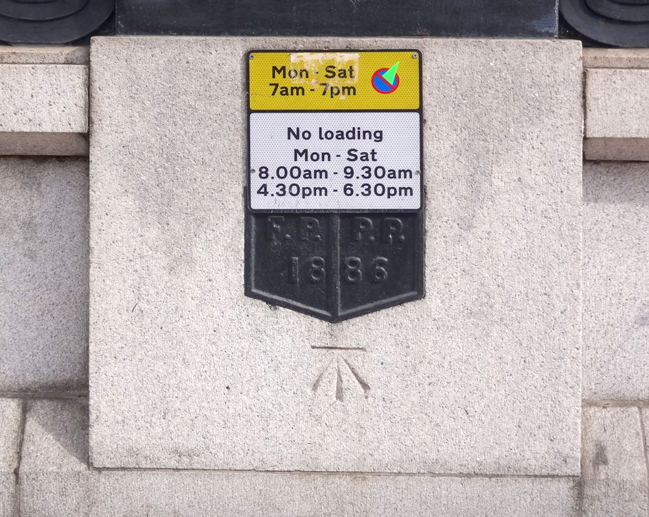
RCH002: Chiswick Bridge, south-east end; SW14;
29th May 2021 [courtesy of John Liffen] |
| |
 |
WND011: Putney Bridge, east side; SW6/SW11;
11th April 2022 [courtesy of John Liffen] |
| |
| |
| * * * |
| |