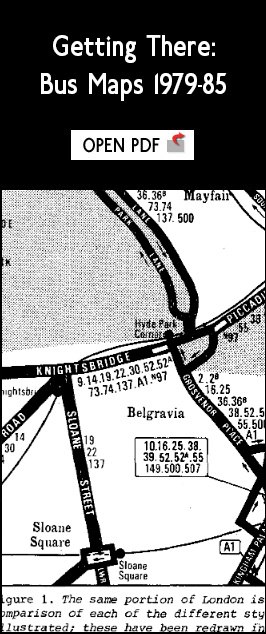
The London General Omnibus Company issued its first bus map in 1910, with bus route numbers appended in numerical order alongside the roads served. Though other styles briefly came and went along the way, this presentation lasted pretty much unchallenged until the early 1980s. That decade then saw a radical change in London Transport’s approach to its bus maps, and the 1990s saw a rebellion against it from within. This is the story of what happened.
Click on the link to the right to read the full original article published by the London Passenger Transport Research Group in their journal London Passenger Transport, No.13 (May 1985). This was later published in the Open University’s own Information Design Journal, Part 1 in Volume 5/1 1986; Part 2 in Volume 5/2 1987. |