 |
|
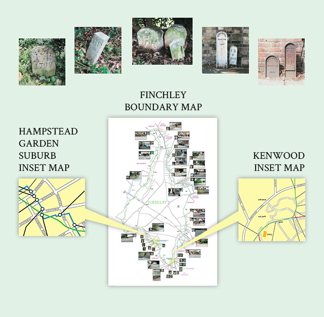
| Click on any of the separate maps which can then be zoomed and panned. The maps include contextual and close-up photographs of all markers found. |
| |
The first thing to say is my knowledge of local authority boundary markers is slim. If you find this section of my website interesting then you really must visit Mike Horne’s website at:
www.metadyne.co.uk/Parishboundaries.html |
| Mike has been extensively surveying, studying and interpreting the areas and boundaries of the civil parishes within the area of the former County of London, in significant detail for many years. In the County of London they were grouped as Metropolitan Boroughs in 1900 and this area now comprise the Inner London boroughs within Greater London. Having got me intrigued, he and I are now doing likewise in Outer London. The maps that accompany this section of my website (see above) show the boundary markers we have found in my local area of Finchley in north London. |
| The boundaries of parishes like Finchley were stable for centuries but as emerging civil functions began to overwhelm parish organization other bodies were established to carry them out. In Finchley a Local Board did this at first, becoming an Urban District in 1894 and a Municipal Borough in 1933. |
| In Finchley (but not always elsewhere) these shared the Civil Parish boundary, the boundary line with neighbouring local authorities being altered several times between 1894 and 1937 to suit the new organizations and reduce anomalies, particularly where boundaries passed through individual properties. The maps, representing snapshots over time, cannot show all the boundary alterations but the boundary lines indicated on the Ordnance Survey 1895 1:2500 map are depicted here by a green line and the later 1930s movements in blue. (Relevant boundaries of neighbouring parishes are shown in purple.) Finchley became part of the London Borough of Barnet, and part of Greater London, in 1965. This map is a work in progress and subject to revision as and when further information becomes known. |
| In most cases the boundaries were not marked on the ground, except by occasional metal or stone markers placed at points where the invisible boundary line changed course. It should be noted however that most of the western boundary with Hendon was unmarked on the ground as Dollis Brook and Mutton Brook defined it absolutely. In a few places today these brooks follow a slightly different course from 1894. (It may be noted that the general rule is that boundaries follow the centre of streams and alter with time as does the route of the stream. However, when a stream is altered by man (and perhaps violently altered by nature) the old boundary route persists. Both Dollis and Mutton Brooks have been culverted in places and this leaves the boundary lying on the stream’s old course.) |
Of the very few boundary stones along the brooks marked on old maps, none has been found to date. However, one stone has been found at Henley’s corner on the roadway/pavement which crosses above Mutton Brook and was indeed for Finchley with Hendon. Allied to the maps, each boundary marker found has a close-up photograph and a general contextual view accompanying it. Each also has a ‘PBM’ number and these are Mike Horne’s. On his website you will find an Ordnance Survey national grid reference and a description for each marker, by referring to the relevant number.
Those in the north and north-east of the map, in the PBM1200 series, can be found by clicking:
www.metadyne.co.uk/pdf_files/LPBM_OL1.pdf
Those numbered PBM251 to 500 are at:
www.metadyne.co.uk/pdf_files/LPBM_S2.pdf
Those numbered PBM 501 to 750 are at:
www.metadyne.co.uk/pdf_files/LPBM_S3.pdf |
| |
| * * * |
| |