 |
Traffic Signs Pre-1965: Directional [further information can be found by clicking here] |
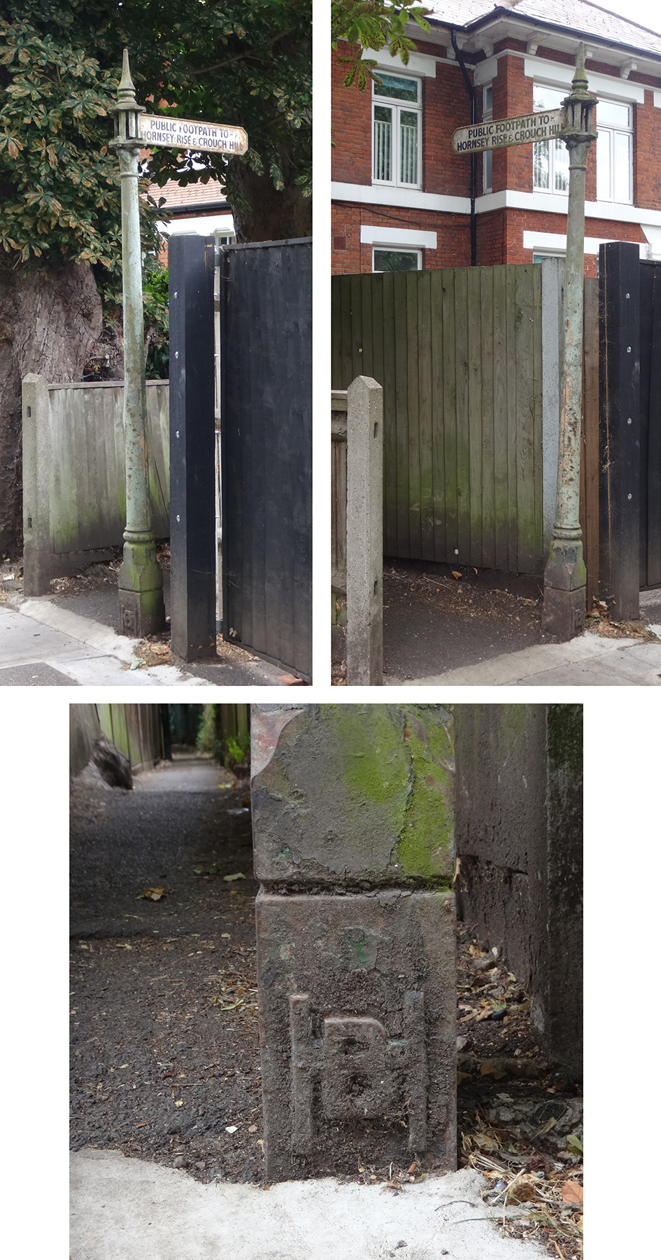 |
HGY085: Haslemere Road, between nos. 4 and 6, at entrance to Vicarage Path; N8;
23rd July 2022 [courtesy of John Liffen] |
| |
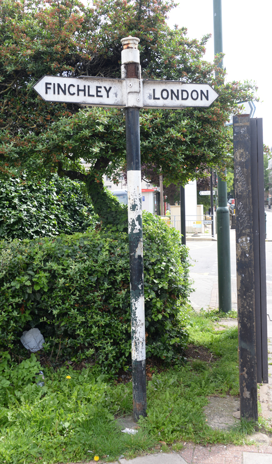 |
BAR136: Finchley Road, at junction with North End Road, north-east corner; NW11;
15th August 2021
|
| |
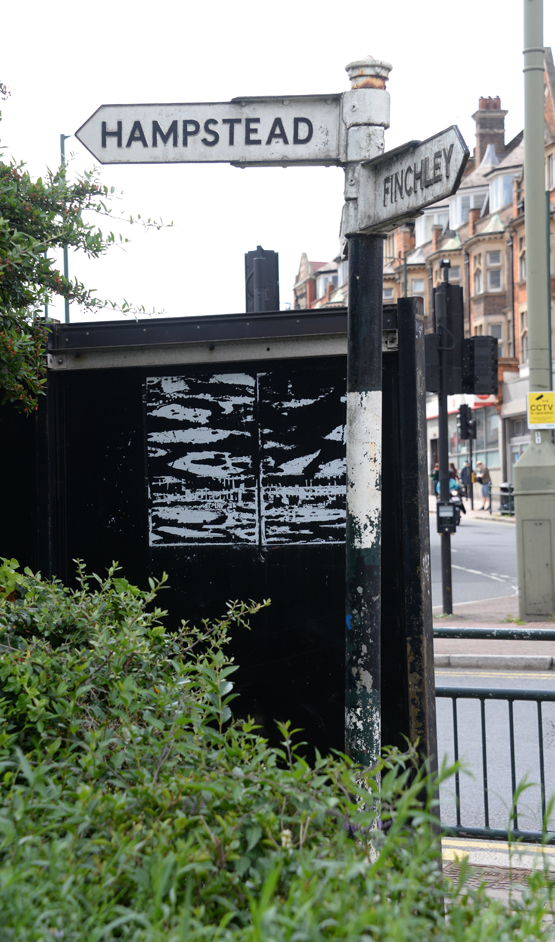 |
BAR136: Finchley Road, at junction with North End Road, north-east corner; NW11;
15th August 2021
|
| |
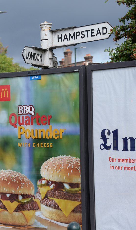 |
BAR136: Finchley Road, at junction with North End Road, north-east corner; NW11;
15th August 2021
|
| |
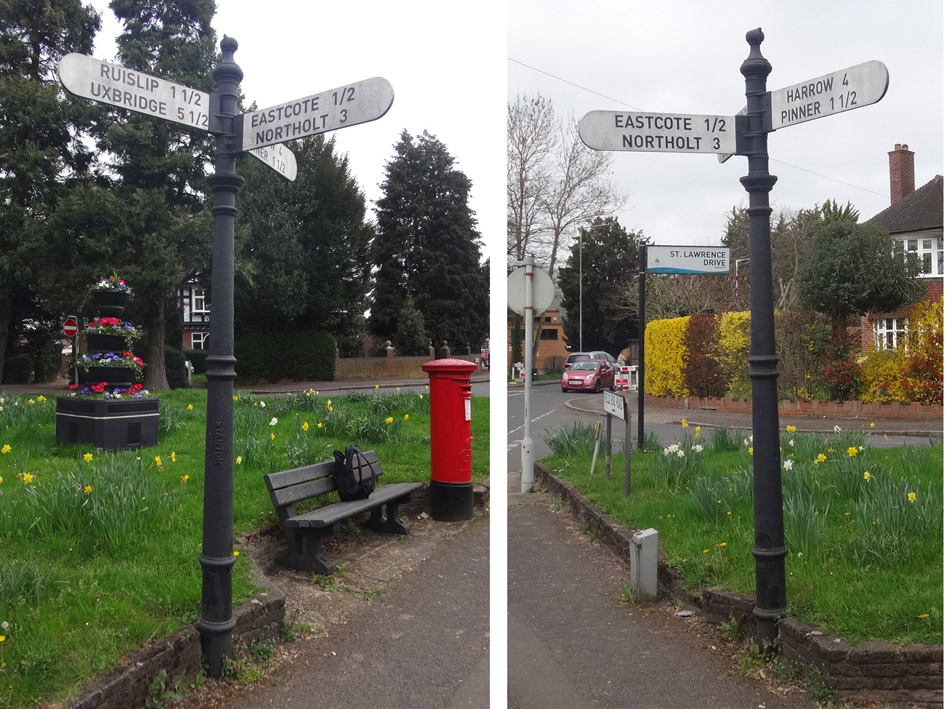 |
HIL003: Field End Road at junction with Lawrence Drive and Bridle Road [backs blank]; HA5;
1st April 2021 [courtesy of Jon Liffen]
|
| |
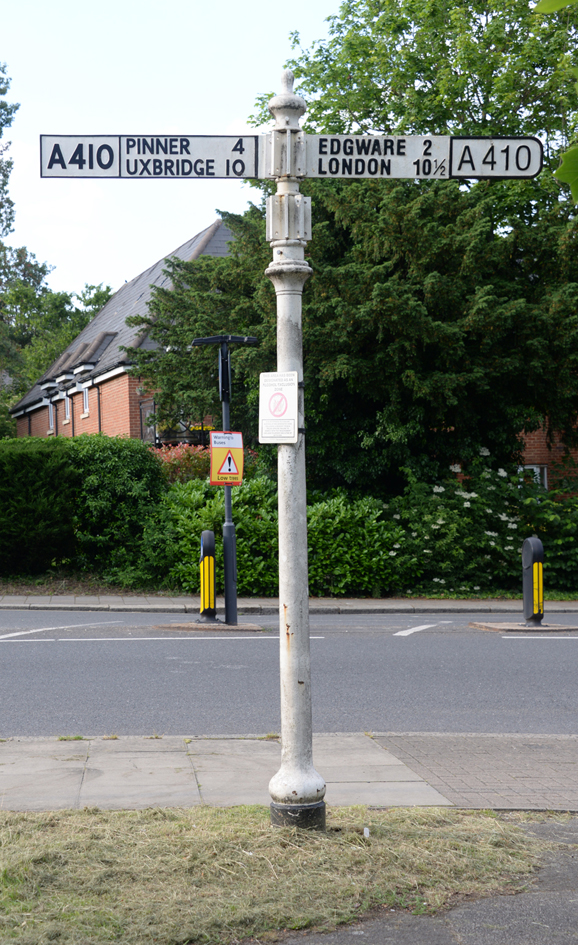 |
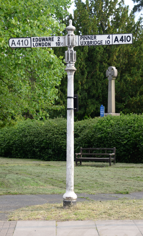
HRW007: Uxbridge Road, junction with Old Church Lane; HA7;
23rd May 2021
|
| |
 |
HRW007: Uxbridge Road, junction with Old Church Lane; HA7;
23rd May 2021
|
| |
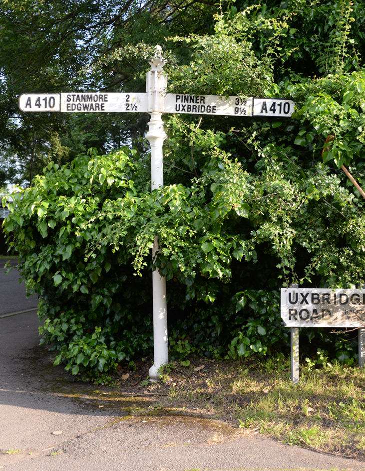 |
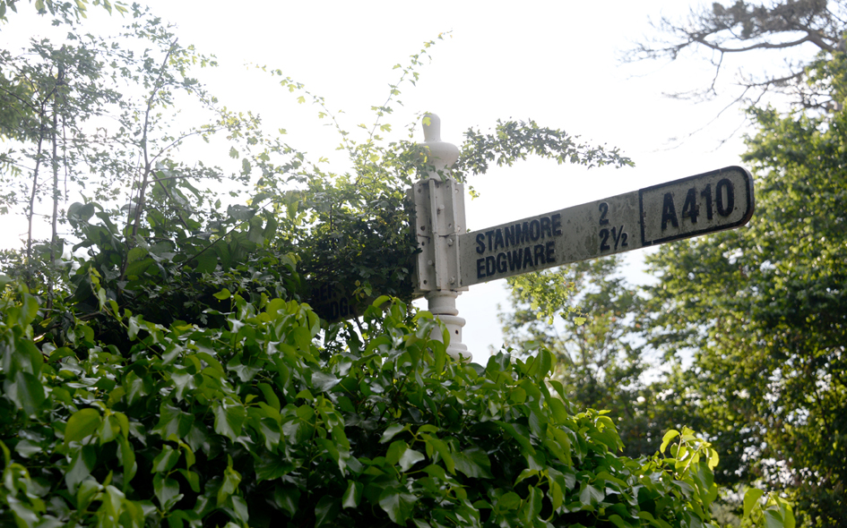
HRW008: Uxbridge Road, junction with Elms Road; HA3;
23rd May 2021
|
| |
 |
HRW008: Uxbridge Road, junction with Elms Road; HA3;
23rd May 2021
|
| |
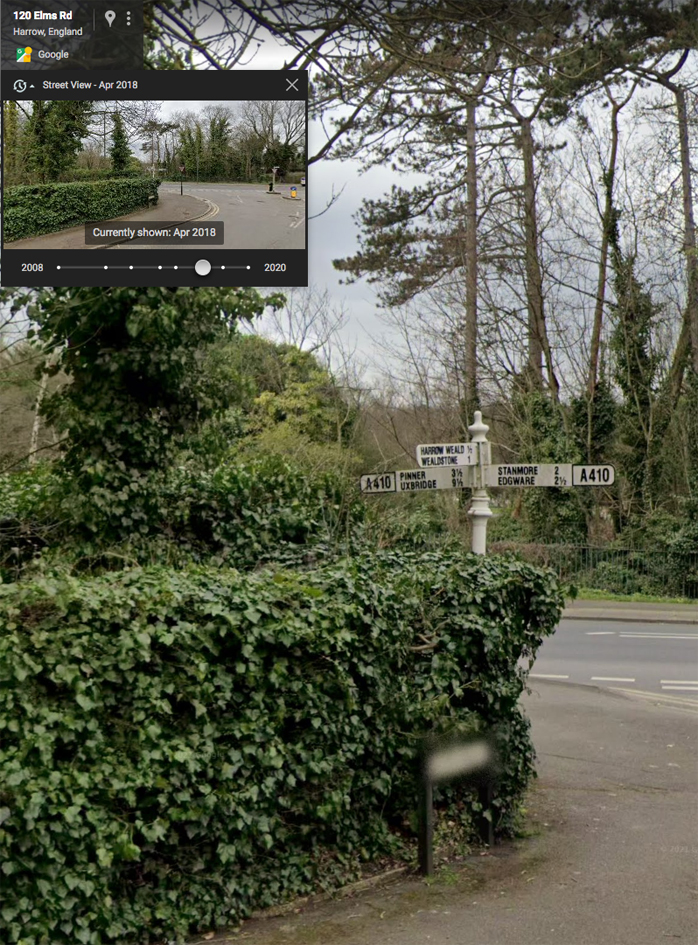 |
HRW008: Uxbridge Road, junction with Elms Road; HA3;
Google Street View April 2018
|
| |
 |
HGY072: The Plantation, roundabout refuge at top of Muswell Hill; N10;
7th November 2021 [courtesy of John Liffen] |
| |
 |
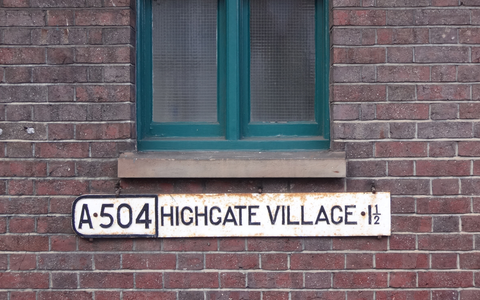
HGY082: Clock Tower, east side, The Broadway, Crouch End; N8;
13th April 2022 [courtesy of John Liffen] |
| |
 |
HGY083: Clock Tower, west side, The Broadway, Crouch End; N8;
13th April 2022 [courtesy of John Liffen] |
| |
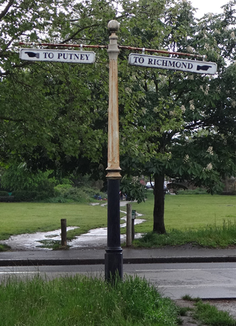 |
RCH001: Upper Richmond Road, at apex of junction with Queens Ride; SW15;
24th May 2021 [courtesy of John Liffen]
|
| |
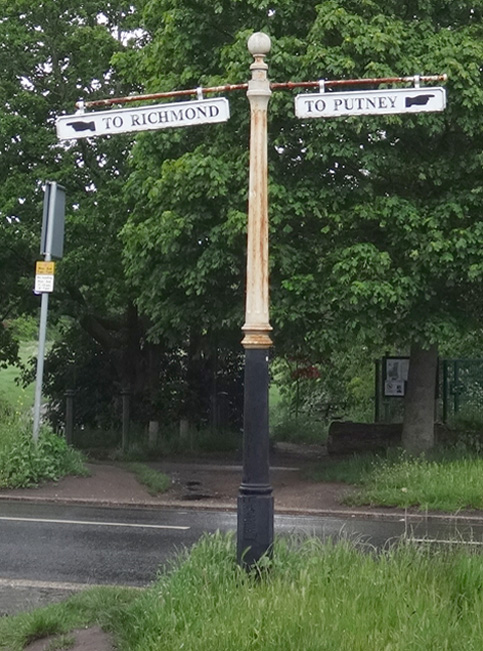 |
RCH001: Upper Richmond Road, at apex of junction with Queens Ride; SW15;
24th May 2021 [courtesy of John Liffen]
|
| |
 |
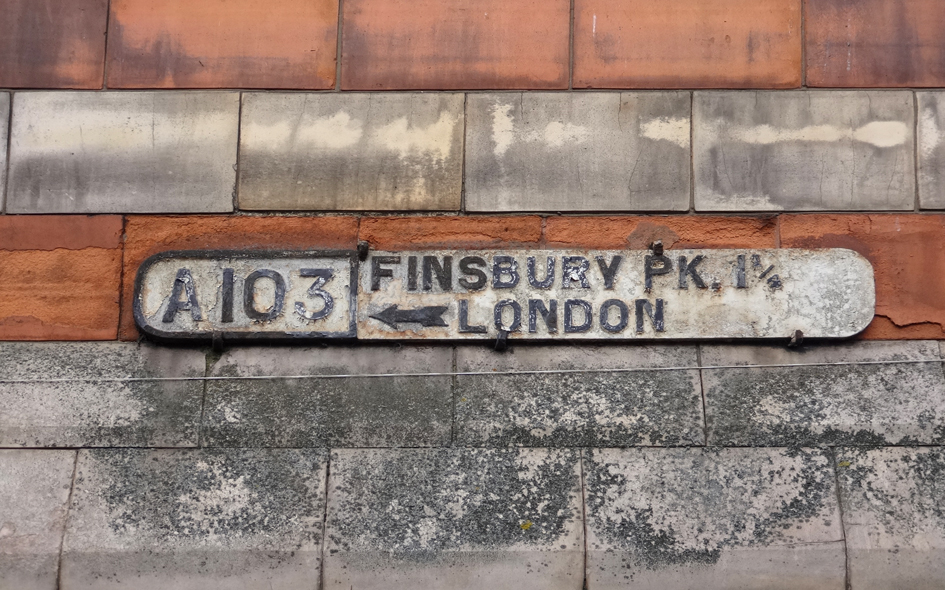
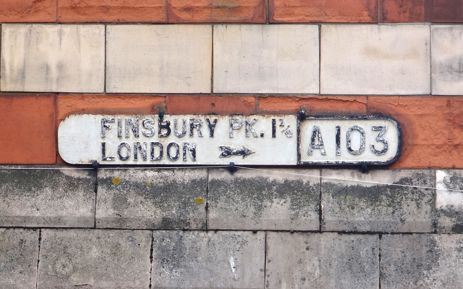
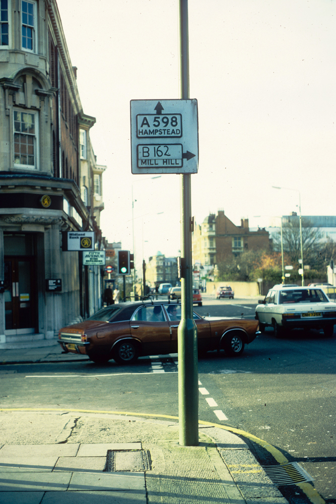
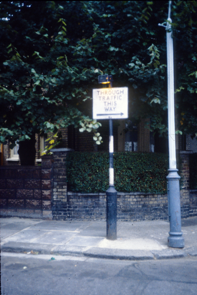
ISL023: Holloway Road, outside no.174; N7;
26th December 1982
|
| |
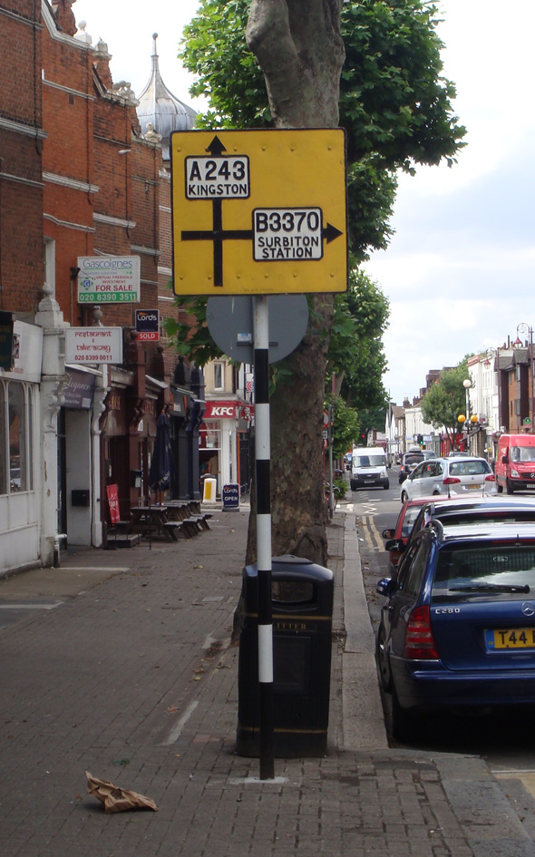 |
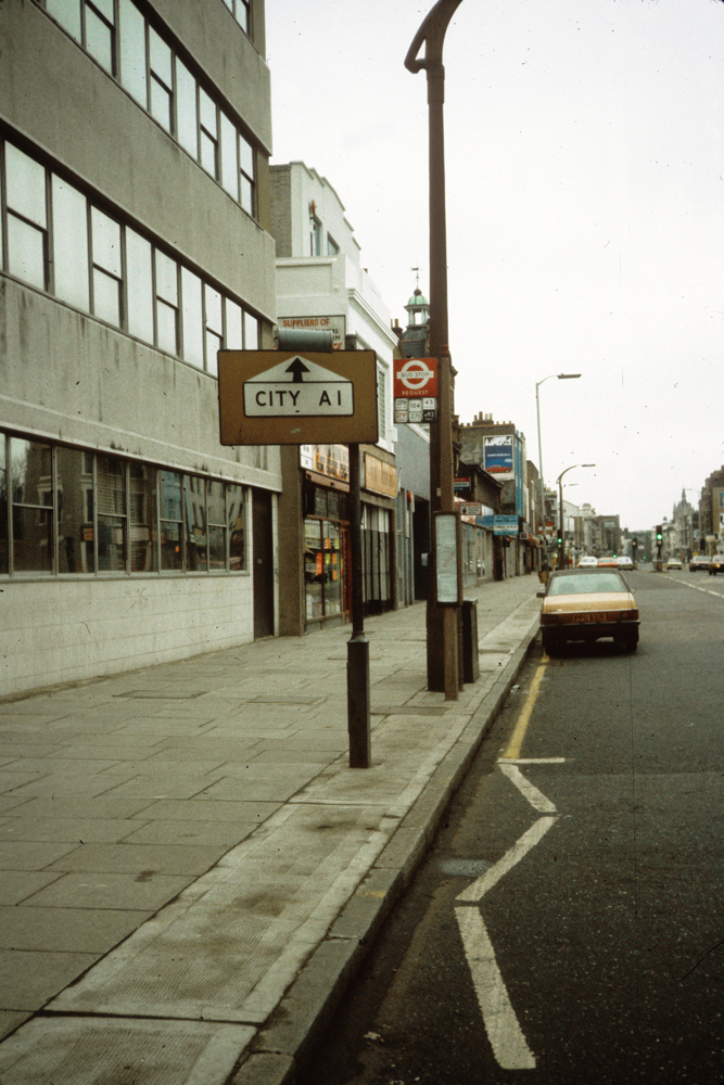
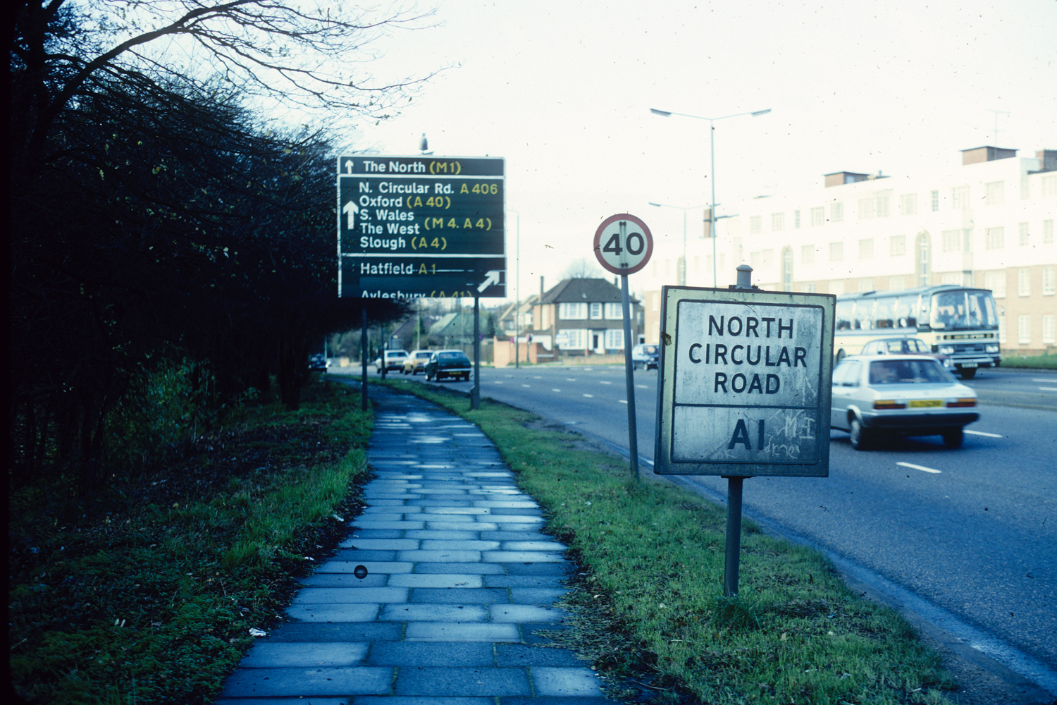
KNG001: Brighton Road (A243) near junction with Victoria Road; KT6;
29th July 2013 [courtesy of John Liffen]
|
| |
 |
BAR112: Ballards Lane, at junction with Hervey Close; N3;
20th November 1982
|
| |
 |
BAR113: Regent’s Park Road, at junction with Lichfied Grove; N3;
20th November 1982
|
| |
 |
BAR114: Regent’s Park Road, at junction with Spencer Close; N3;
20th November 1982
|
| |
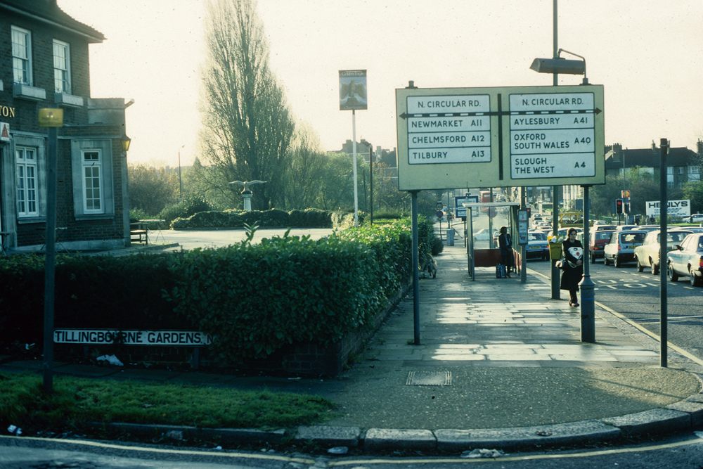 |
BAR115: Regent’s Park Road, at junction with Tillingbourne Gardens; N3;
20th November 1982
|
| |
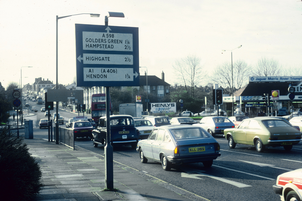 |
BAR116: Regent’s Park Road, east side, just north of North Circular Road; N3;
20th November 1982
|
| |
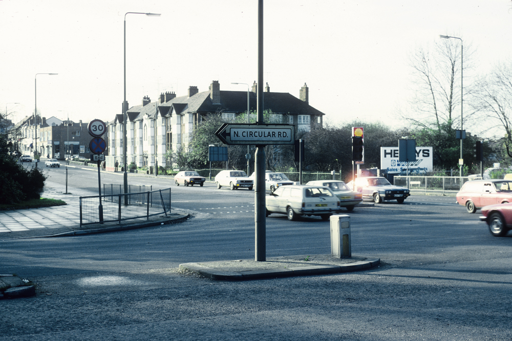 |
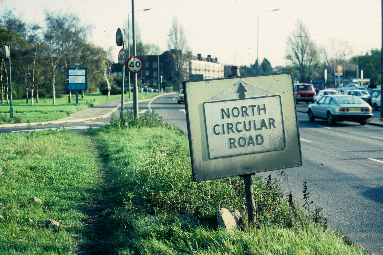
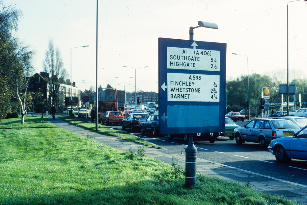
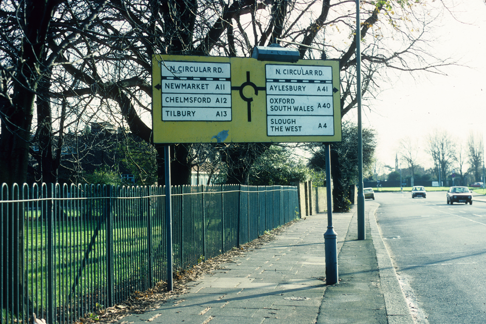
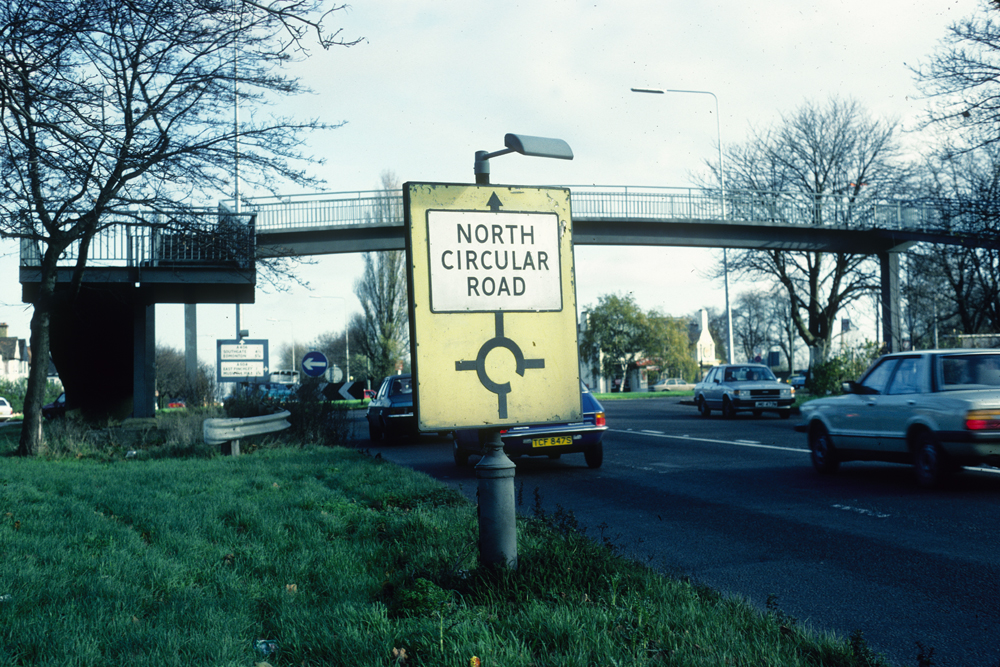
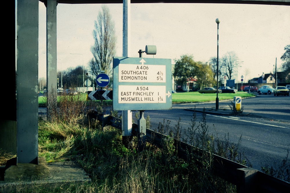
BAR117: Henlys Corner, North Circular Road, east of junction with Regent’s Park Road; N3;
20th November 1982
|
| |
 |
BAR118: Henlys Corner, Finchley Road, west side, just south of North Circular Road; NW7;
20th November 1982
|
| |
 |
BAR119: Henlys Corner, North Circular Road, south side, just west of Finchley Road; NW7;
20th November 1982
|
| |
 |
BAR120: Henlys Corner, North Circular Road, north side, just west of Regent’s Park Road; N3;
20th November 1982
|
| |
 |
BAR121: Henlys Corner, North Circular Road, north side, just west of Regent’s Park Road; N3;
20th November 1982
|
| |
 |
BAR122: East End Road, north side, about 70 metres west of North Circular Road; N3;
20th November 1982
|
| |
 |
BAR123: East End Road, north side, just west of North Circular Road; N3;
20th November 1982
|
| |
 |
BAR124: North Circular Road, north side, just west of East End Road; N3;
20th November 1982
|
| |
 |
BAR125: North Circular Road, north side, about 70 metres west of East End Road; N3;
20th November 1982
|
| |
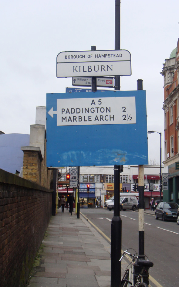 |
CAM031: Belsize Road, approaching junction with Kilburn High Road; NW6;
25th February 2011 [courtesy of John Liffen]
|
| |
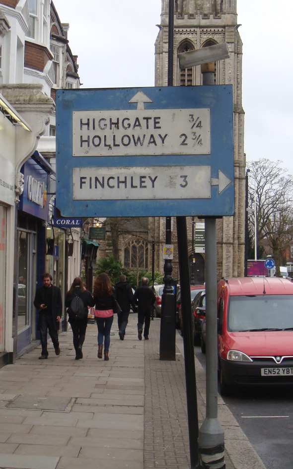 |
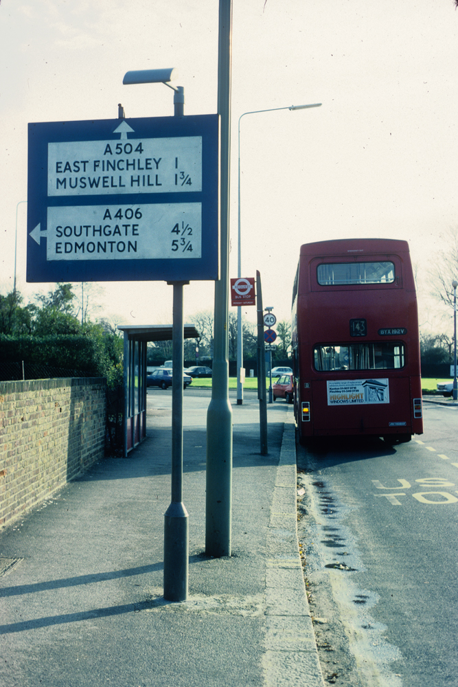
HGY061: Muswell Hill Broadway, near junction with Fortis Green Road; N10;
25th February 2011 [courtesy of John Liffen]
|
| |
 |
HGY059: Manor Road, north side, near junction with Stamford Hill; N16;
13th April 2021 [courtesy of John Liffen]
|
| |
 |
H&F011: Bulwer Street, at junction with Caxton Road; W12;
6th October 1985
|
| |
| |
| * * * |
| |