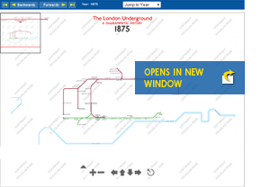
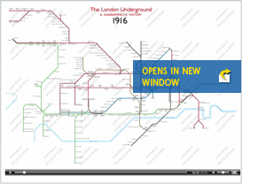
Though based on the Diagrammatic History this section allows you to get a better idea of the stages of evolution of the London Underground network. The Zoomable Maps button allows you to run through time, year by year, and there is a map for every individual year where change has happened. The Video Animation button allows you to run from 1863 to 2008 as slide show of evolution.
Journey Through Time Zoomable Maps
By using the Backwards and Forwards arrows or Jump to Year from the drop down list, you can either run through the years at your own pace or see what the state of development was for any individual year. When viewing any year’s map you can zoom in and out for more detail and navigate around using the tools at the bottom. You can also click and drag to pan your way around. The thumbnail map at the top left shows you where you are.
Journey Through Time Video Animation This section allows you to sit back and watch the map grow (and contract) as the years progress. You can pause, forward and rewind this animation at any time. To see these individual maps in more detail, see the Zoomable Maps.